-
196559th
Year2024 -
-
-

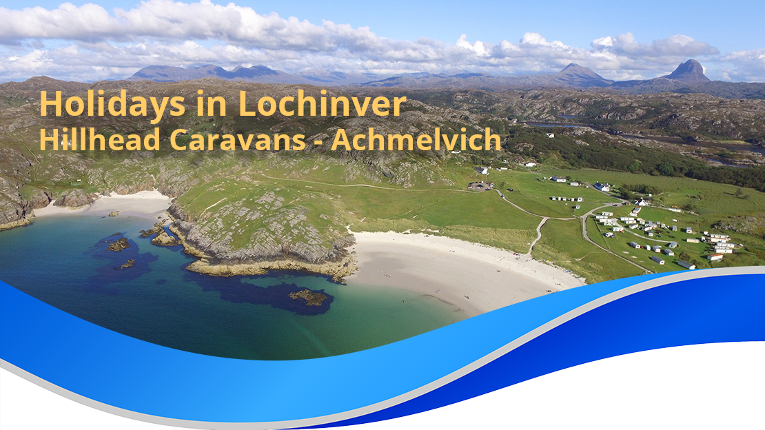
Scotland’s First Geopark – North West Highlands
What is a Geopark?
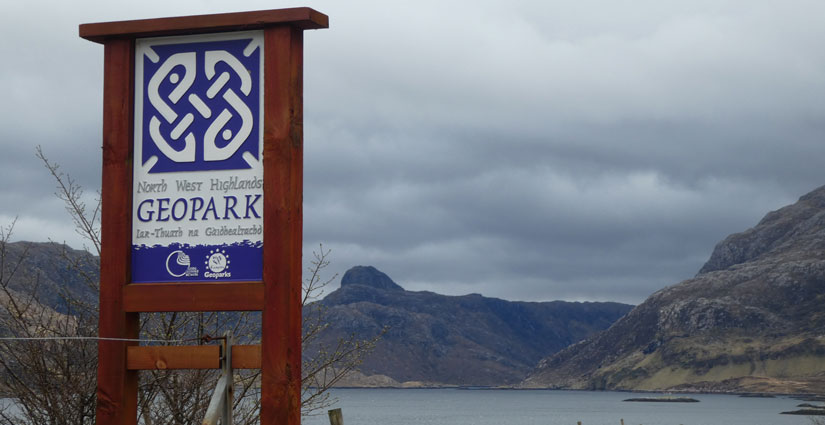
The most North Westerly corner of the Highlands has been awarded Global recognition as an Internationally recognised European Geopark. These are areas of clearly defined geological heritage of particular importance in terms of its scientific quality, rarity, aesthetic appeal and educational values.
The aim of a European Geopark is to protect geological heritage, promote it to the public and to use it and other aspects of its natural and cultural heritage to promote sustainable economic development, usually through tourism. In February 2004, the European Geoparks network was integrated into the UNESCO endorsed Global Geoparks Network.
Geological Wonders and Natural Beauty
Assynt is in the centre of this area to receive this accolade, the area stretches from Loch Erribol to Cape Wrath in the far north, down the west through Assynt to Knockan and Achiltibuie (see map).
Visit the ROCK SHOP / Tea Room in the old Unapool School Building near Kylesku
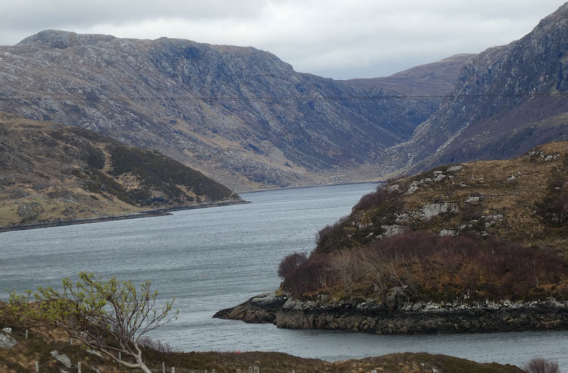
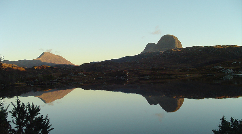
This 2,000 sq km area encompasses some of the finest mountain and coastal landscapes in Britain, containing a wealth of classic geological localities. It holds the iconic mountains of Stac Pollaidh, Suilven, Canisp, and Arkle, and contains the beautiful clean beaches of Achmelvich, Oldshoremore, Sandwood and Balnakiel, and along the coast there are many dramatic cliffs with those at Cape Wrath forming the most north west tip of Scotland.
The very rich and natural heritage of the North West Highlands is recognised in the high number of designated areas and sites; there are the Assynt Coigach and North West Sutherland National Scenic Areas, two National Nature Reserves, 54 Geological Conservation Review sites, 26 Geological Sites of Special Scientific Interest, 17 Special Protection Area Sites and 11 Special Areas of Conservation.
The area contains many historical and archaeological sites, including scheduled monuments and listed buildings. Gathered from early evidence for human habitation in Scotland, through to Norse settlements, the Lordship of the Isles to the Clearances, crofting and recent land reform, this human story is traced in the landscape for more than 9,000 years.
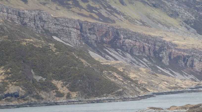
Geologically, the area is dominated by the internationally important Moine Thrust Zone, this runs north to south. To the west lies the Lewesian Gneiss Complex, containing some of the oldest rocks in Europe, and to the east are the enigmatic rocks of the Moine Supergroup.
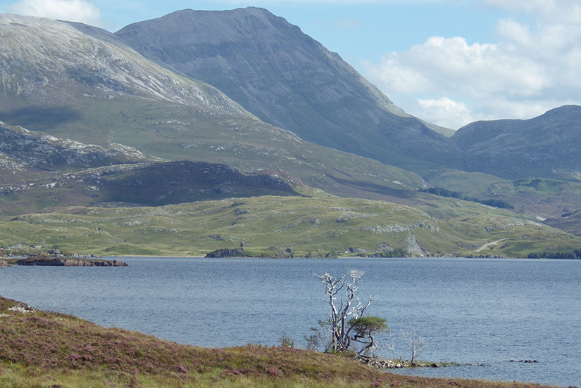
As we all know, the North West Highlands has a unique landscape, strikingly reflecting the underlying geology and geomorphology. Along the line of the Moine Thrust Zone are craggy peaks of Torridonian Sandstone and Cambrian Quartzite, long shaped by the glacial actions form the Quarternary period. Found between these mountains are the many secluded glens, some floored by the largest areas of limestone in Scotland, and caves in the limestone have yielded much fossil evidence of Pleistocene “ice age” fauna, reindeer, polar bears and wolves.
On the west the rugged coastline of Lewesian Gneiss shows up with its typical lochs and crags landscape, full of small coves and craggy headlands. Machair grass covers the unusual sands, and in turn show off their rich varieties of flora, and the high cliffs and sea stacks such as the Old Man of Stoer, are formed from Torridonian sandstone. Then to the east of the mountains one has the wild boggy grounds that developed on the rocks of the Moine Supergroup.
Famous Vistors & Those Wishing to Learn
The area attracted many famous geologists, such as Benjamin Peach and John Horne, Archibald Geikie, and Roderick Murchison, John Horne is famous for his mapping of Assynt, which has proven a very valuable historic record of the many small townships from the past. This is a key area in the historical development of geological science, and research into the rocks and structures and geomorphological features is continuing to this day as hundreds of students worldwide visit the area every year.
Future Hopes & Thanks
A report from the British Geological Survey and Highland Council states that hopes are high that the new status will herald exciting new initiatives in Earth science interpretation, education and education throughout the North West Highlands. A Geopark Action Group oversees the running and policy direction of the Geopark, and a Geopark Officer carries out the roles of identify, secure and develop community led projects linked to the Geopark initiative.
We welcome this international recognition of our beautiful and remote part of North West Scotland. We have always known and appreciated its rich natural splendour, and believe the Geopark initiative will be a wonderful opportunity for visitors and locals alike to benefit from the landscape.
We would like to express our sincere thanks to the now disbanded Sutherland Partnership who steered this bid to its very successful conclusion; it was a huge undertaking, but was presented by people who love and appreciate our beautiful land, and many of whom holiday here.